H.E.S.S. Galactic Plane Survey
HGPS paper (April 2018) online material
H.E.S.S. is an array of ground-based gamma-ray telescopes located in Namibia. The H.E.S.S. Galactic Plane Survey (HGPS) is the first deep and wide survey of the Milky Way in TeV gamma-rays.
This webpage contains the online material (survey maps, source catalog, figures) for the HGPS paper that was released in April 2018. This paper and the data products below cover HGPS observations taken from 2004 to 2013.
The HGPS paper is available here:
The HGPS data is available for download below, as well as here:
The HGPS paper was published as part of the special issue in Astronomy & Astrophysics:
- A & A special issue - "H.E.S.S. phase-I observations of the plane of the Milky Way"
- H.E.S.S. press release for the special issue - "Galactic science with 15 years of H.E.S.S. data"
Brief overviews of HGPS are available here:
If you have any questions or comments, contact the corresponding authors (Christoph Deil, Axel Donath, Ryan Chaves, Francois Brun, Vincent Marandon) via the general H.E.S.S. contact address: contact.hess@hess-experiment.eu
Survey Maps (FITS) #
Survey sky maps are released in FITS format. They are described in the paper in Appendix A.1. Each file is ~ 11 MB.
- hgps_map_significance_0.1deg_v1.fits.gz
- hgps_map_significance_0.2deg_v1.fits.gz
- hgps_map_flux_0.1deg_v1.fits.gz
- hgps_map_flux_0.2deg_v1.fits.gz
- hgps_map_flux_err_0.1deg_v1.fits.gz
- hgps_map_flux_err_0.2deg_v1.fits.gz
- hgps_map_flux_ul_0.1deg_v1.fits.gz
- hgps_map_flux_ul_0.2deg_v1.fits.gz
- hgps_map_sensitivity_0.1deg_v1.fits.gz
- hgps_map_sensitivity_0.2deg_v1.fits.gz
The "Extras" section below contains some information how to view and work with the maps.
Source catalog (FITS) #
The source catalog and other tables are released in FITS format. They are described in Appendix A.2 and Tables A.1 - A.9 at the end of the paper. This file is small (~ 50 kB).
The "Extras" section below contains some information how to view and work with the catalog.
Paper figures #
PDF and high-resolution PNG versions of all figures from the paper:
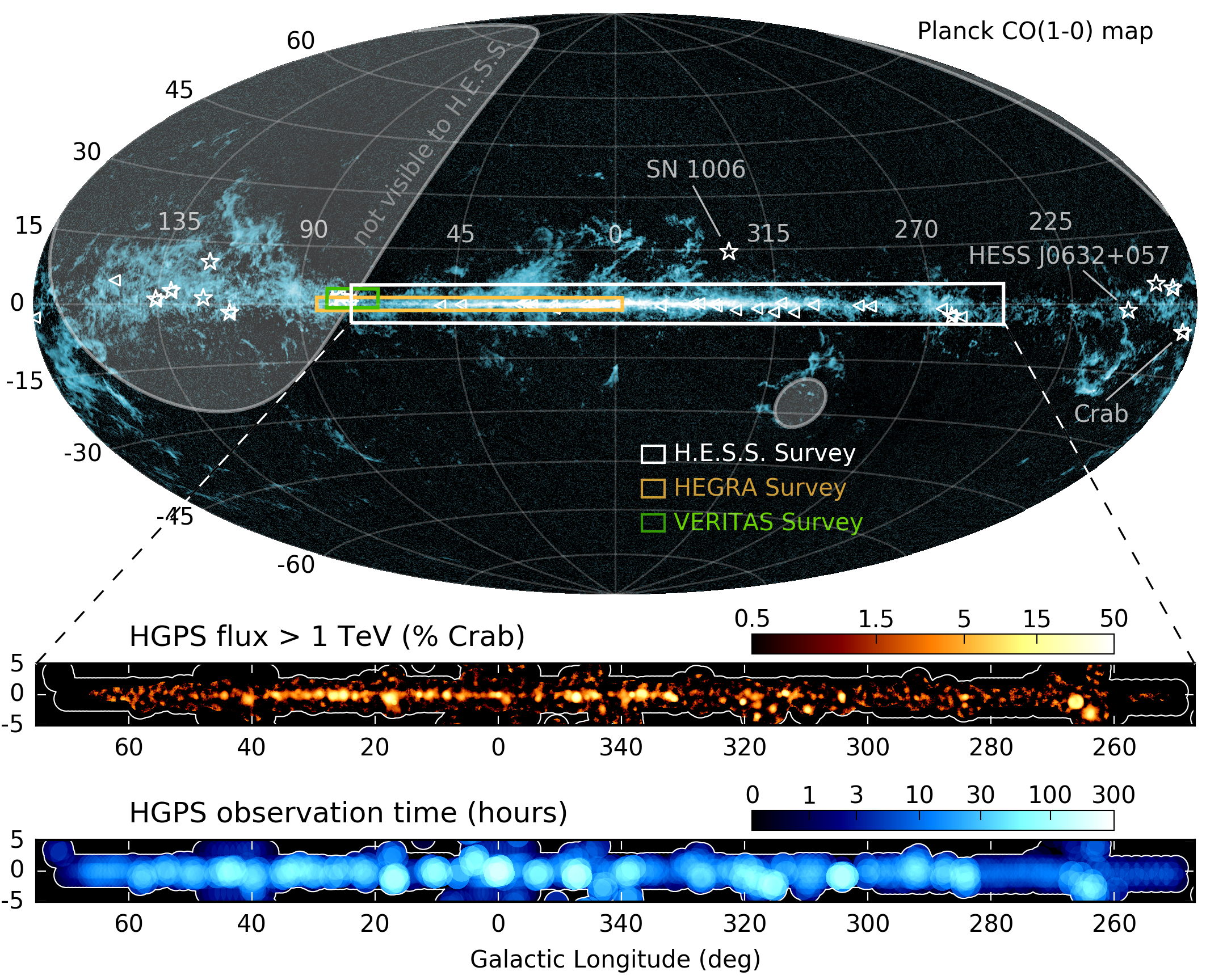
- Figure 1: hgps_region_exposure_illustration.pdf, PNG
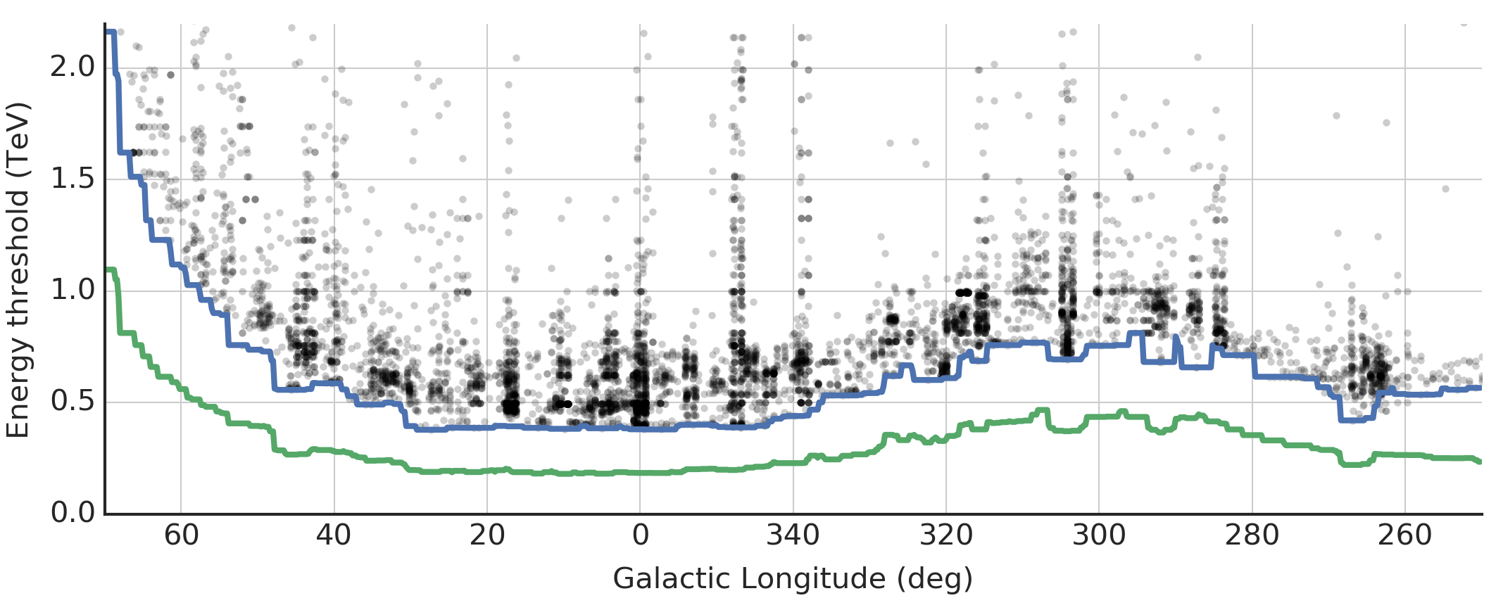
- Figure 2: hgps_energy_threshold_profiles.pdf, PNG
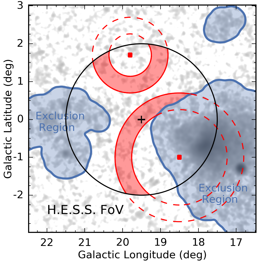
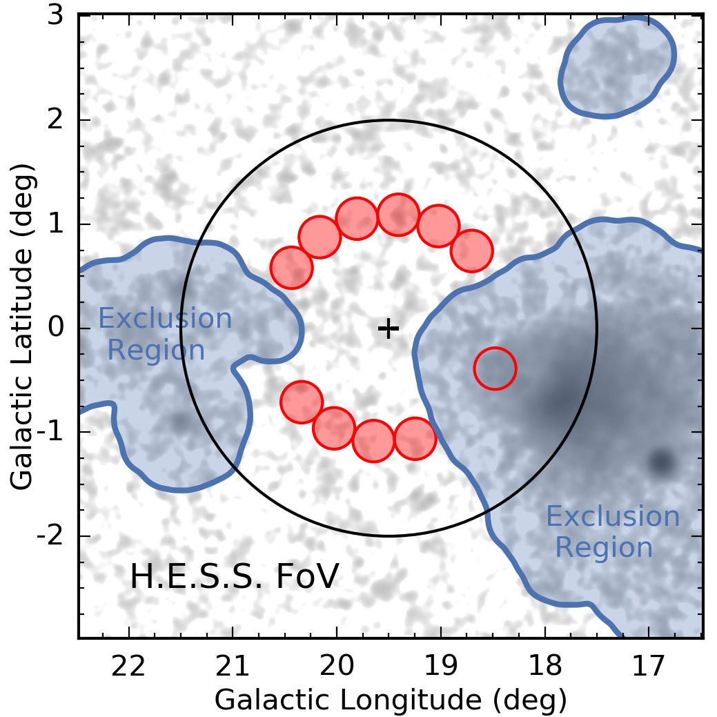
- Figure 3: hgps_map_background_estimation.pdf, PNG
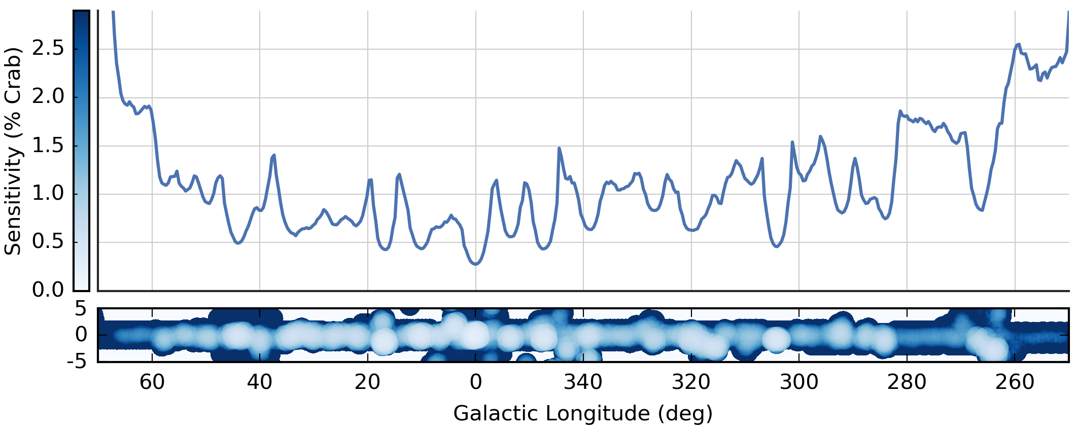
- Figure 4: hgps_sensitivity.pdf, PNG
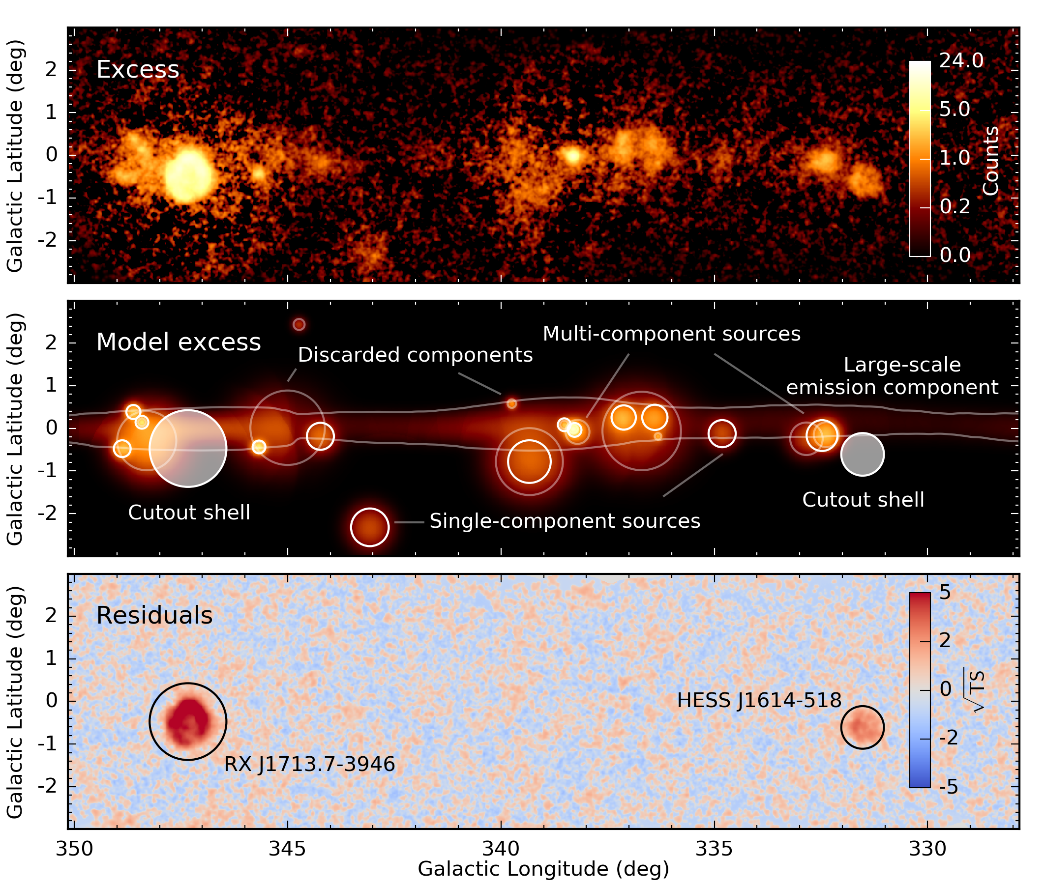
- Figure 5: hgps_catalog_model.pdf, PNG
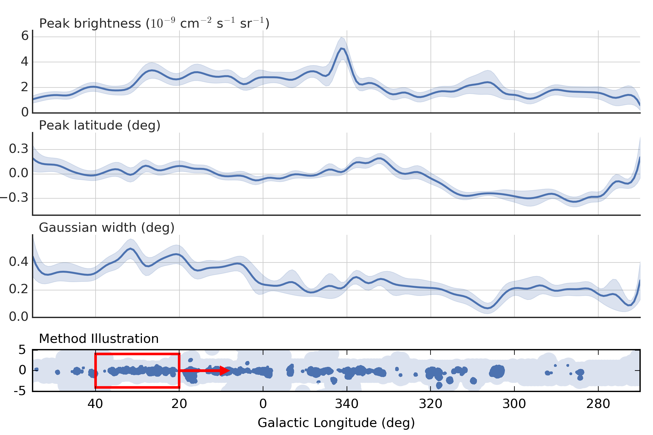
- Figure 6: hgps_diffuse_model.pdf, PNG
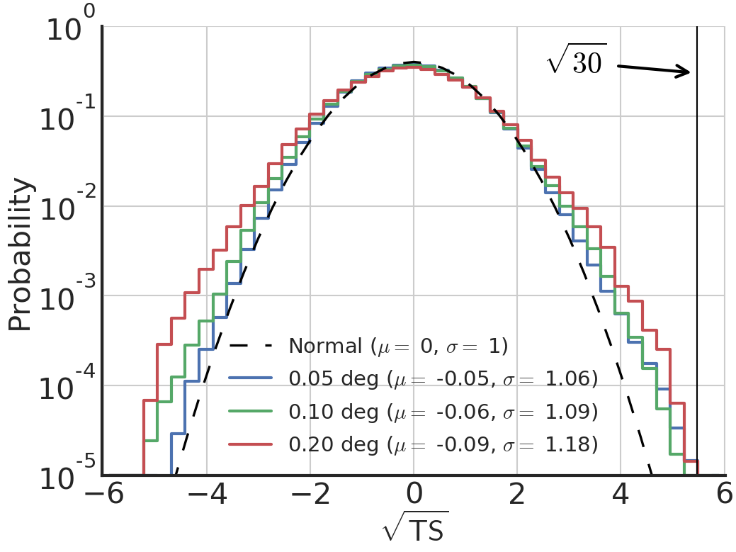
- Figure 7: hgps_residual_distribution_ts.pdf, PNG
- Figure 8: hgps_spectrum_background_estimation.pdf, PNG
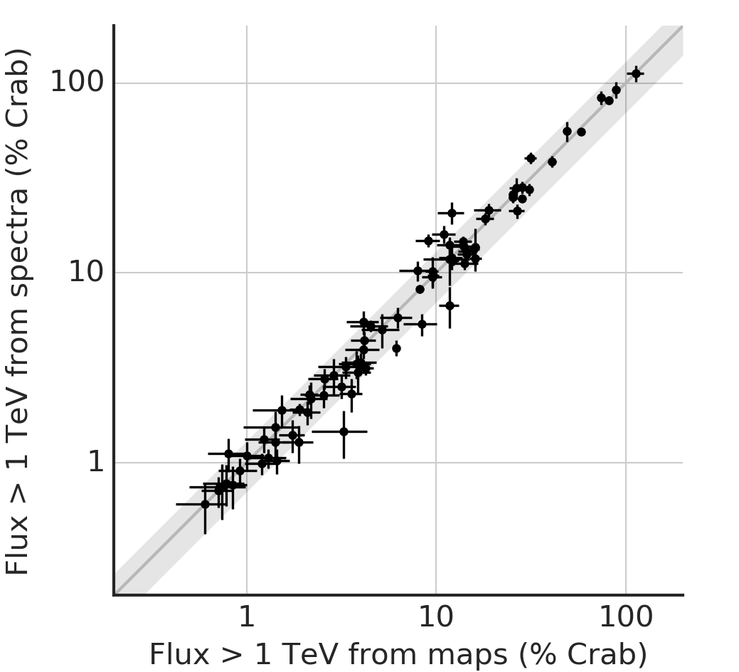
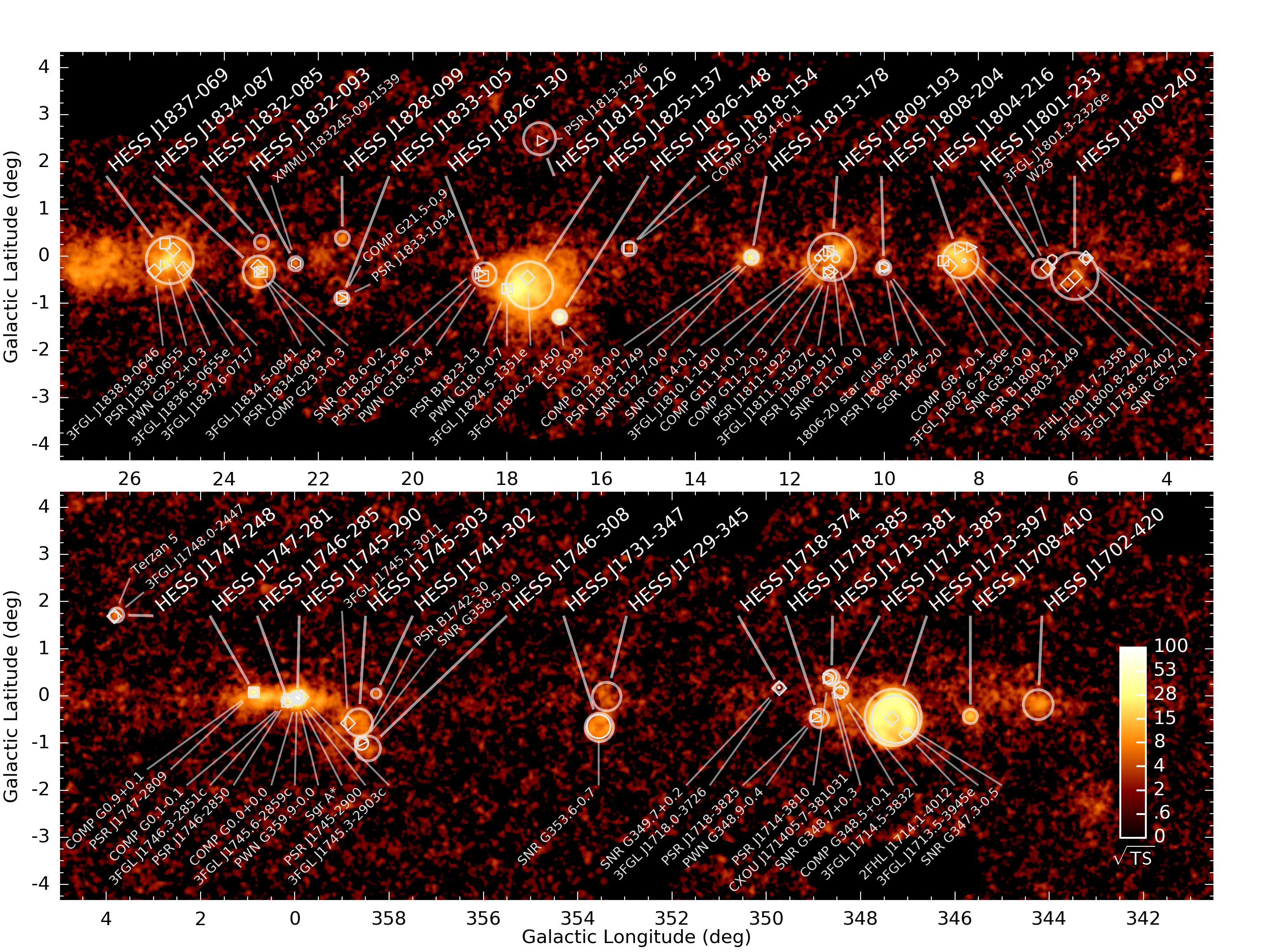
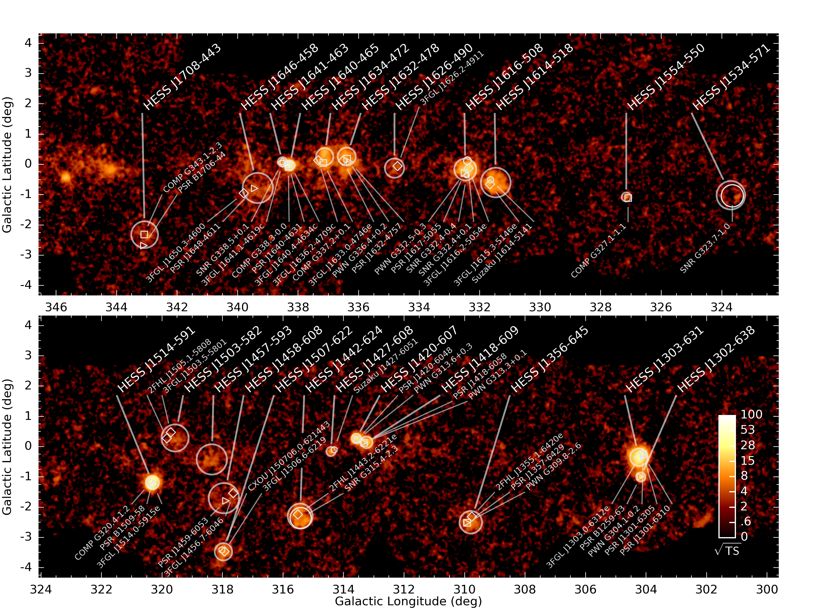
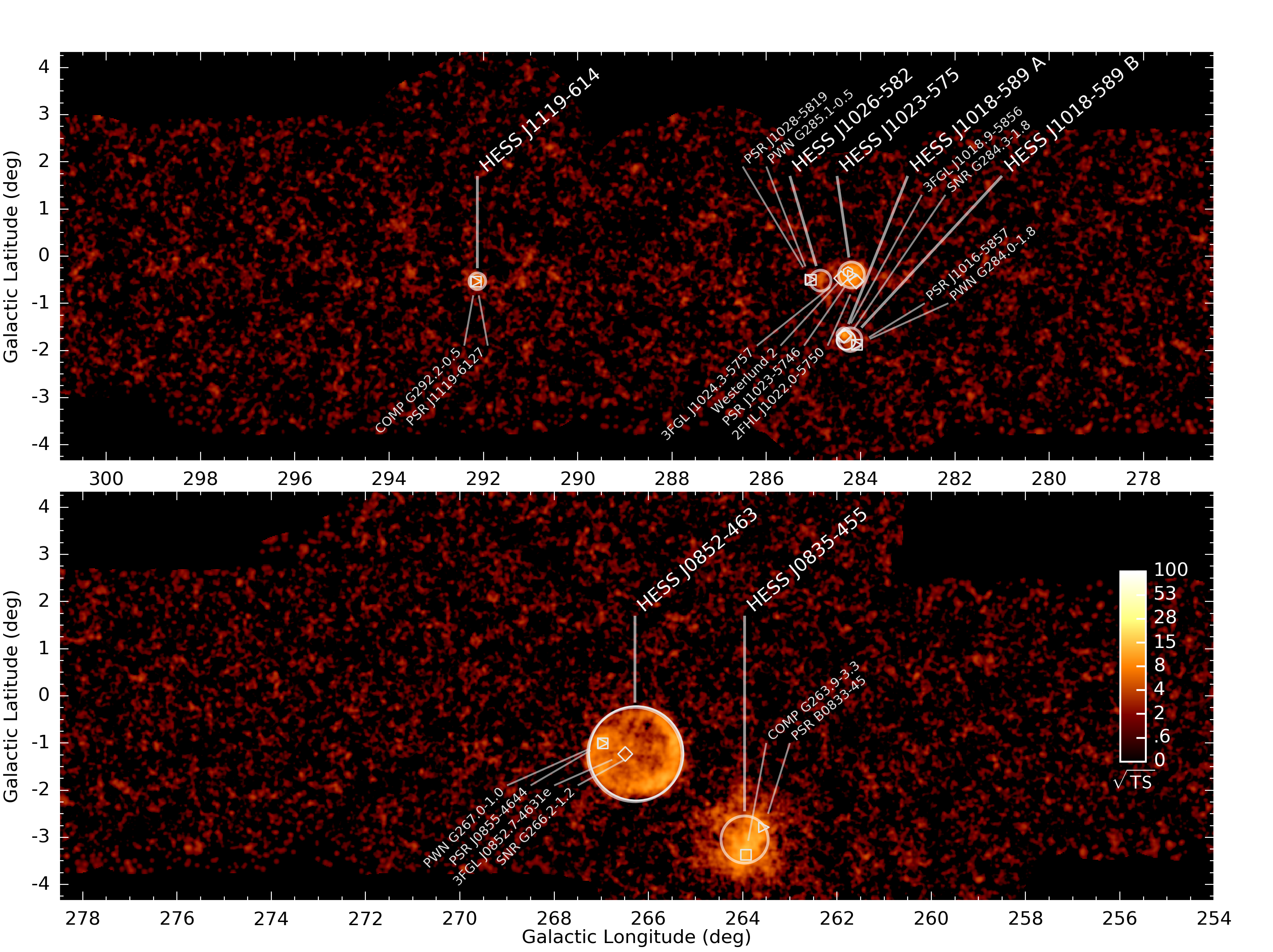
- Figure 9: hgps_sources_spectrum_map_flux_comparison.pdf, PNG
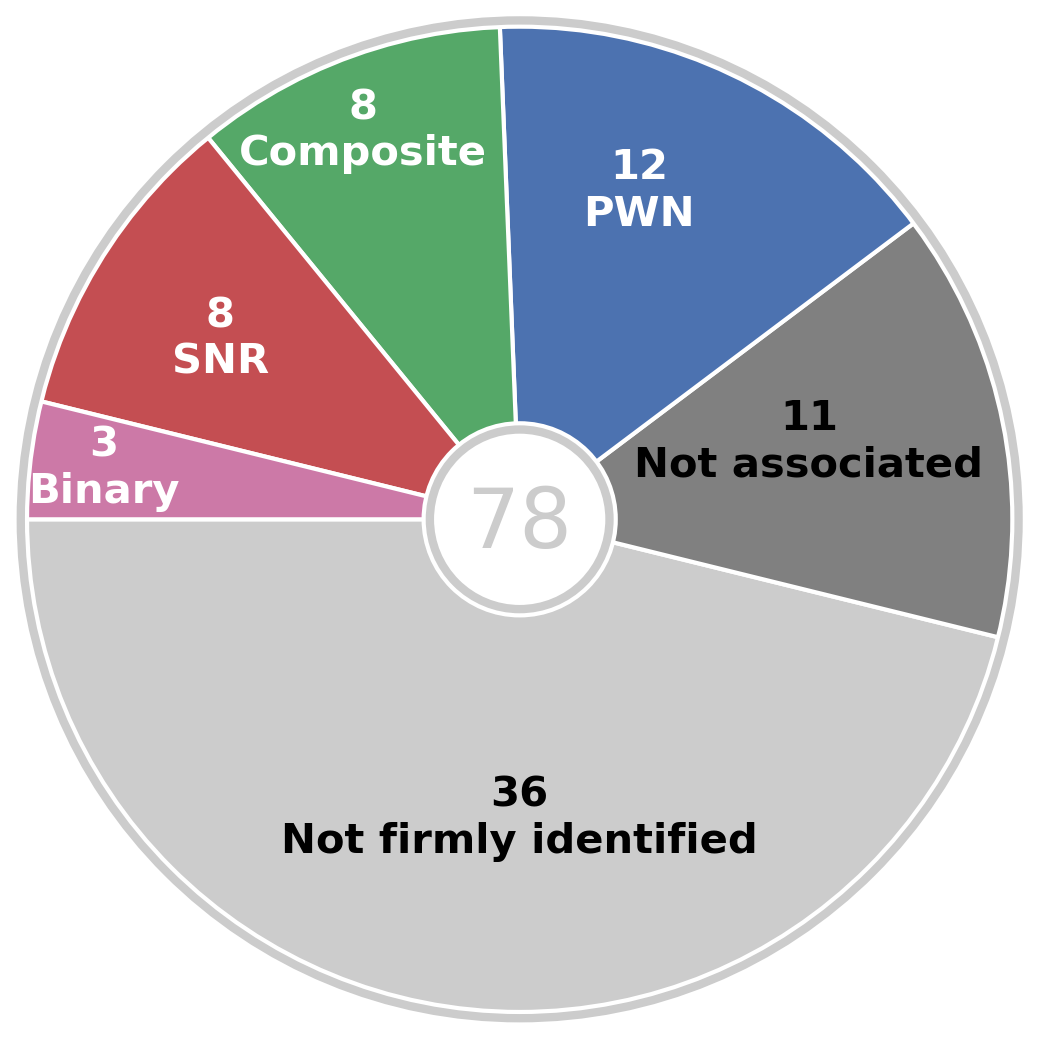
- Figure 10: hgps_source_id.pdf, PNG
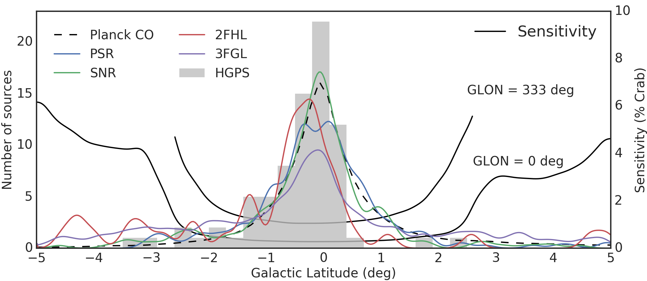
- Figure 11: hgps_sources_glat.pdf, PNG
- Figure 12: hgps_sources_glon.pdf, PNG
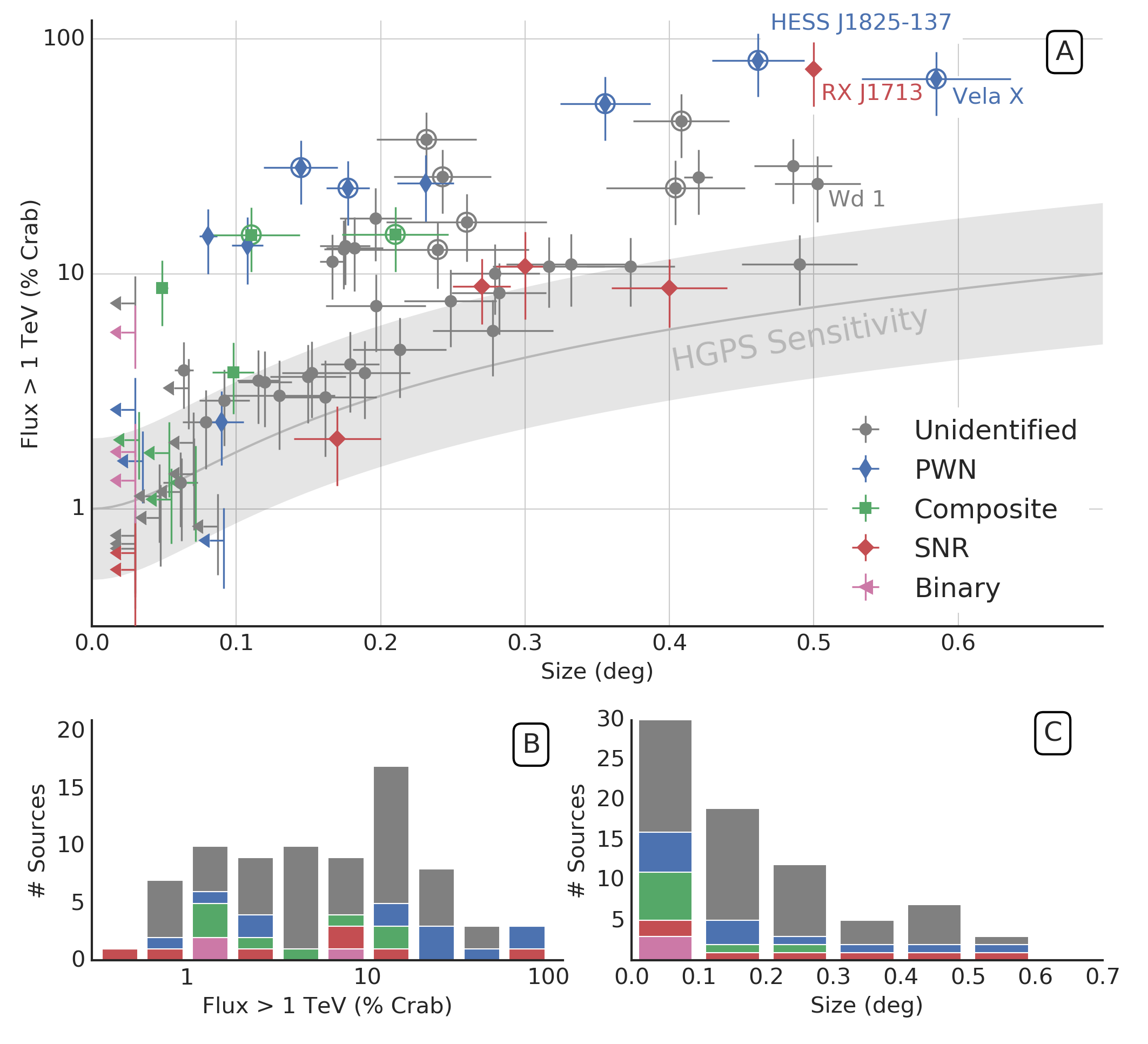
- Figure 13: hgps_sources_flux_extension.pdf, PNG
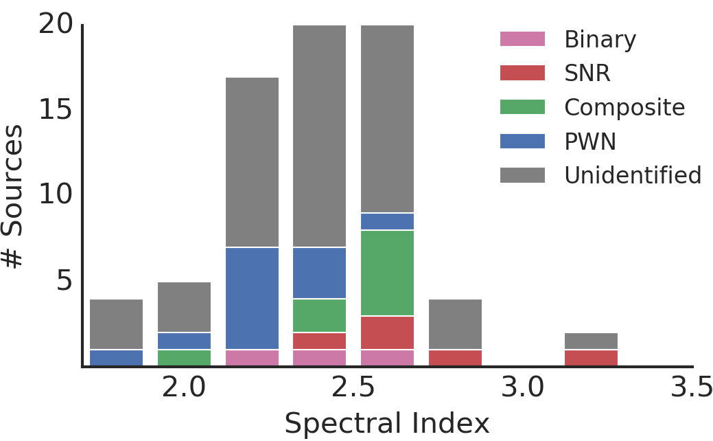
- Figure 14: hgps_sources_spectral_index.pdf, PNG
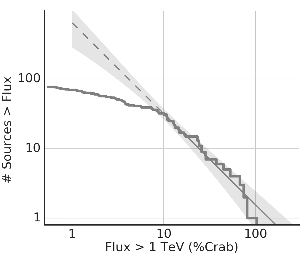
- Figure 15: hgps_sources_log_n_log_s.pdf, PNG
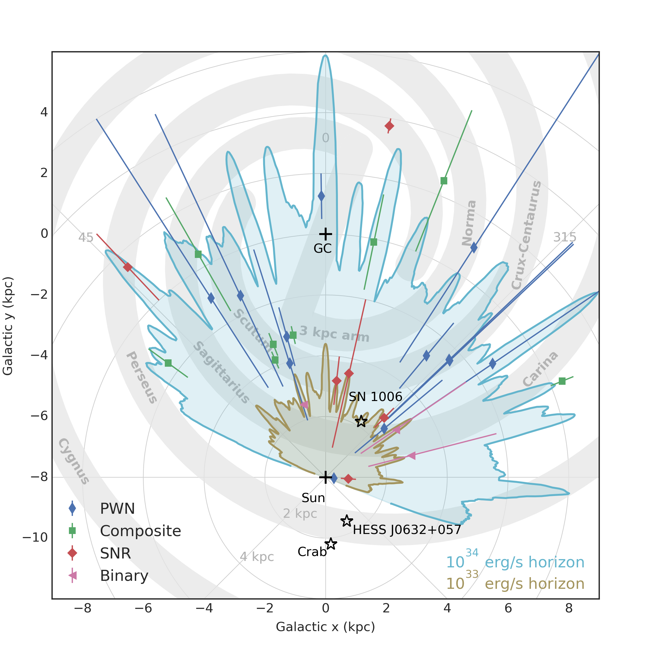
- Figure 16: hgps_face_on_milky_way.pdf, PNG
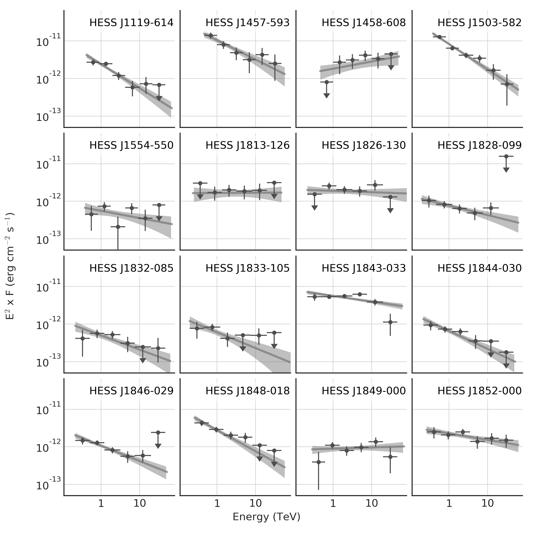
- Figure 17: hgps_spectra_new_sources.pdf, PNG
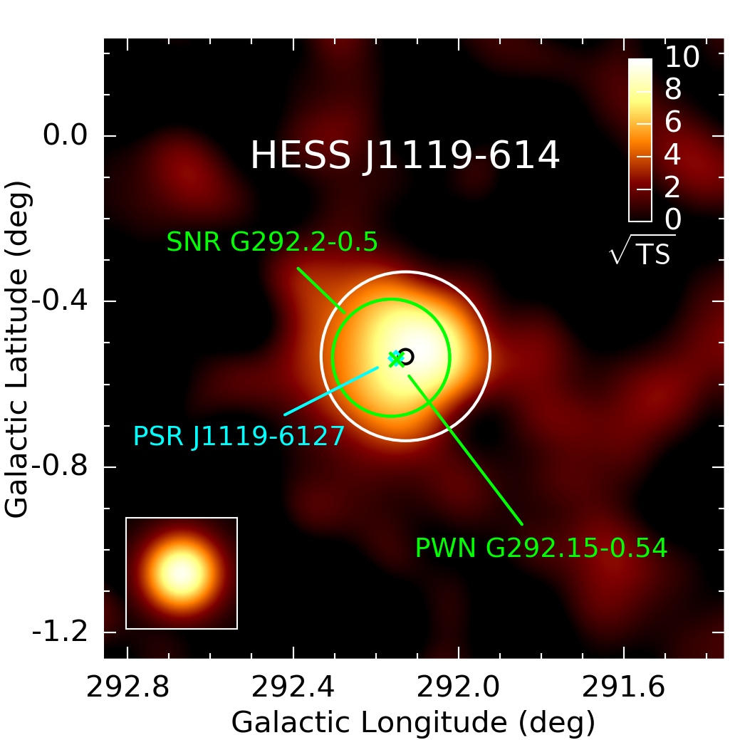
- Figure 18: HESS_J1119m614.pdf, PNG
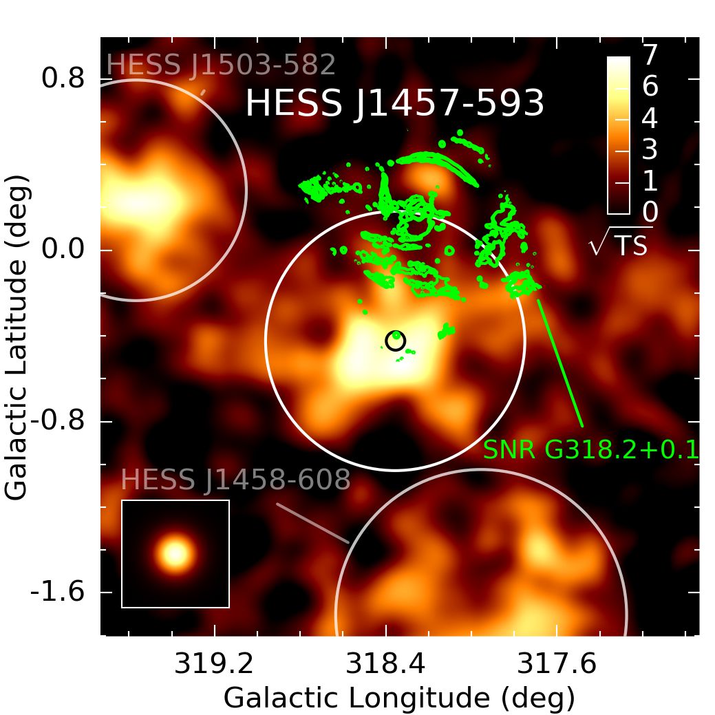
- Figure 19: HESS_J1457m593.pdf, PNG
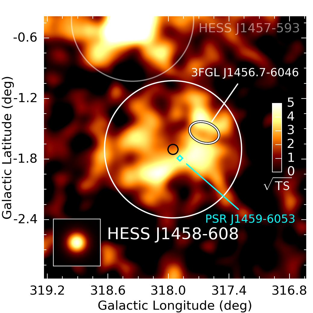
- Figure 20: HESS_J1458m608.pdf, PNG
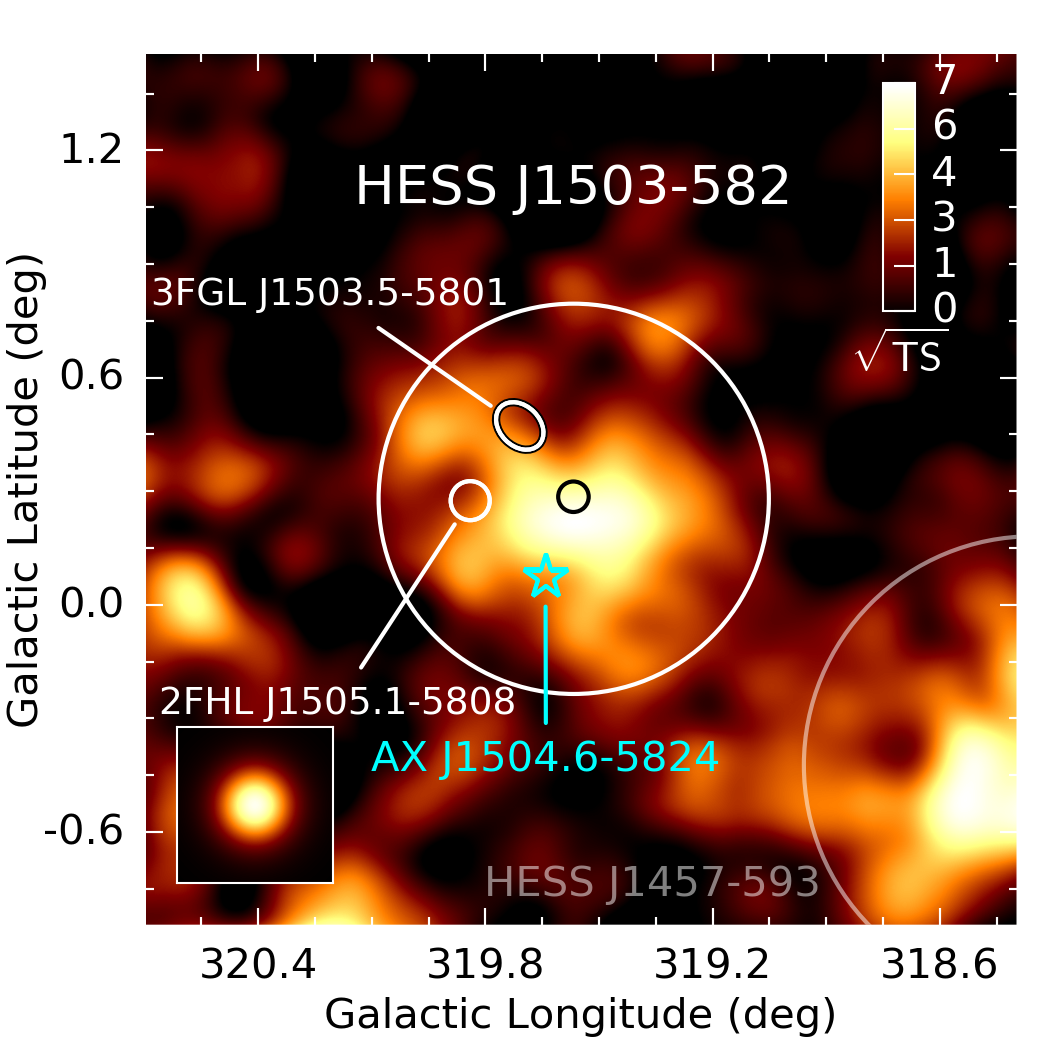
- Figure 21: HESS_J1503m582.pdf, PNG
- Figure 22: HESS_J1554m550.pdf, PNG
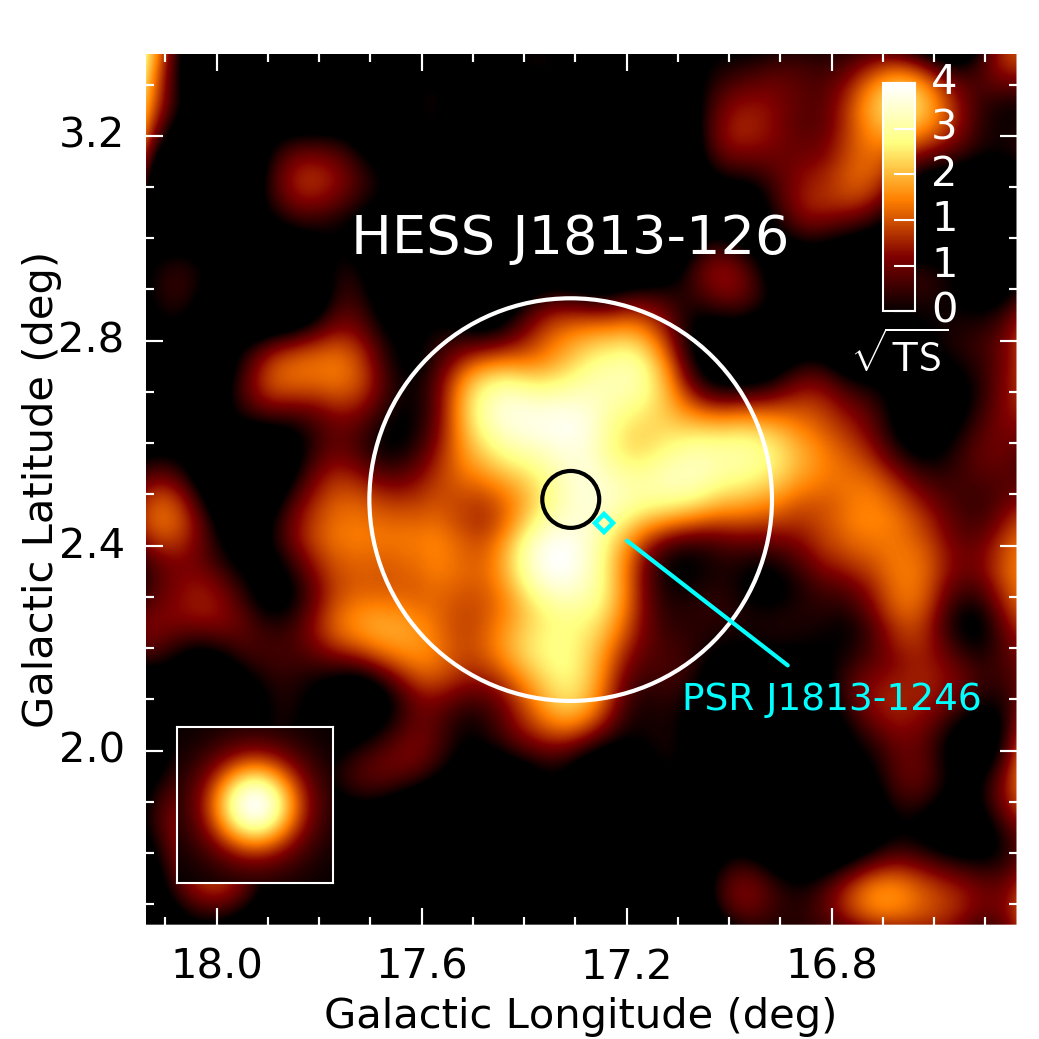
- Figure 23: HESS_J1813m126.pdf, PNG
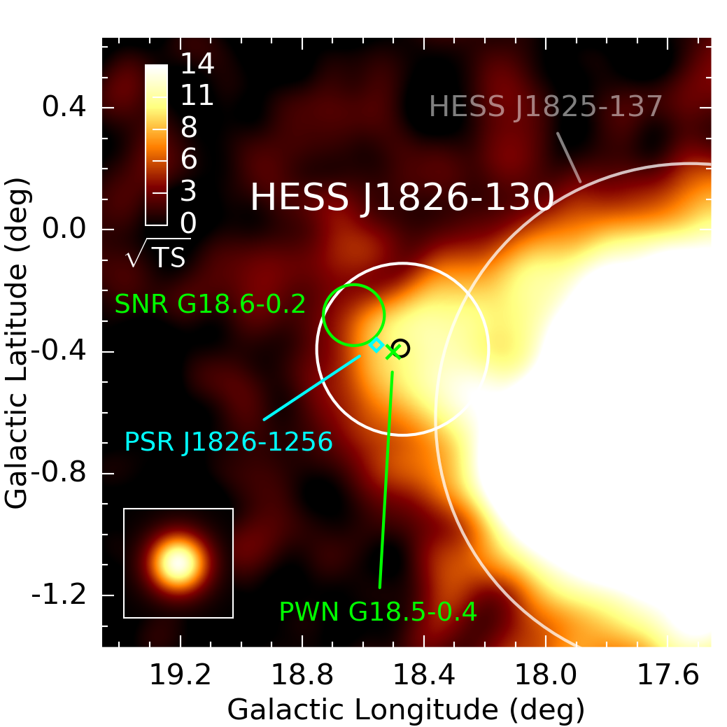
- Figure 24: HESS_J1826m130.pdf, PNG
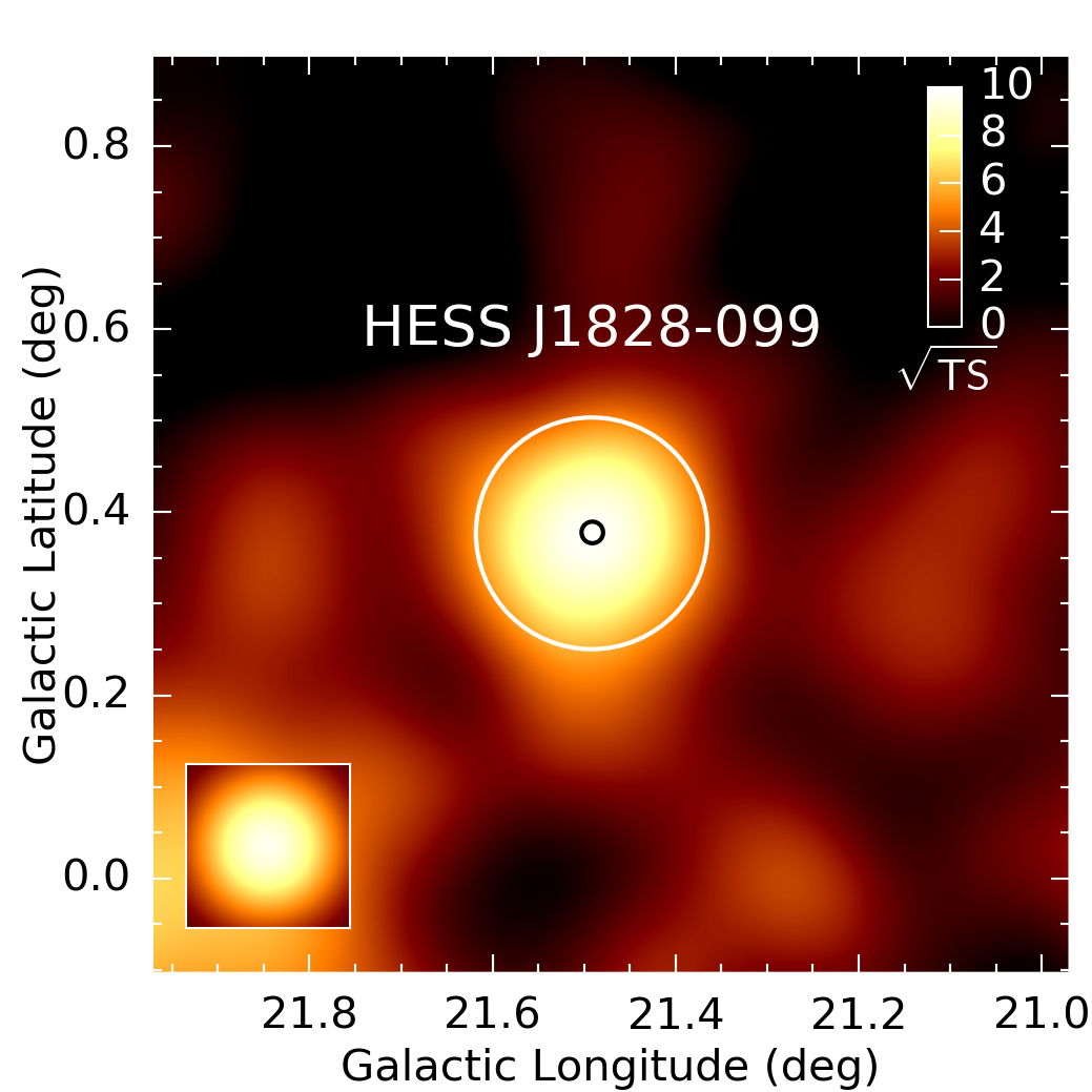
- Figure 25: HESS_J1828m099.pdf, PNG
- Figure 26: HESS_J1832m085.pdf, PNG
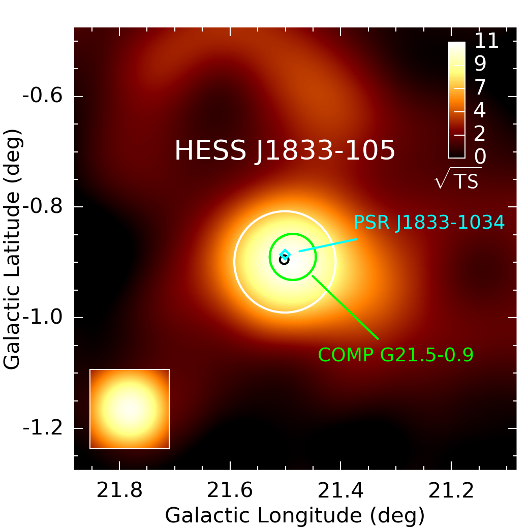
- Figure 27: HESS_J1833m105.pdf, PNG
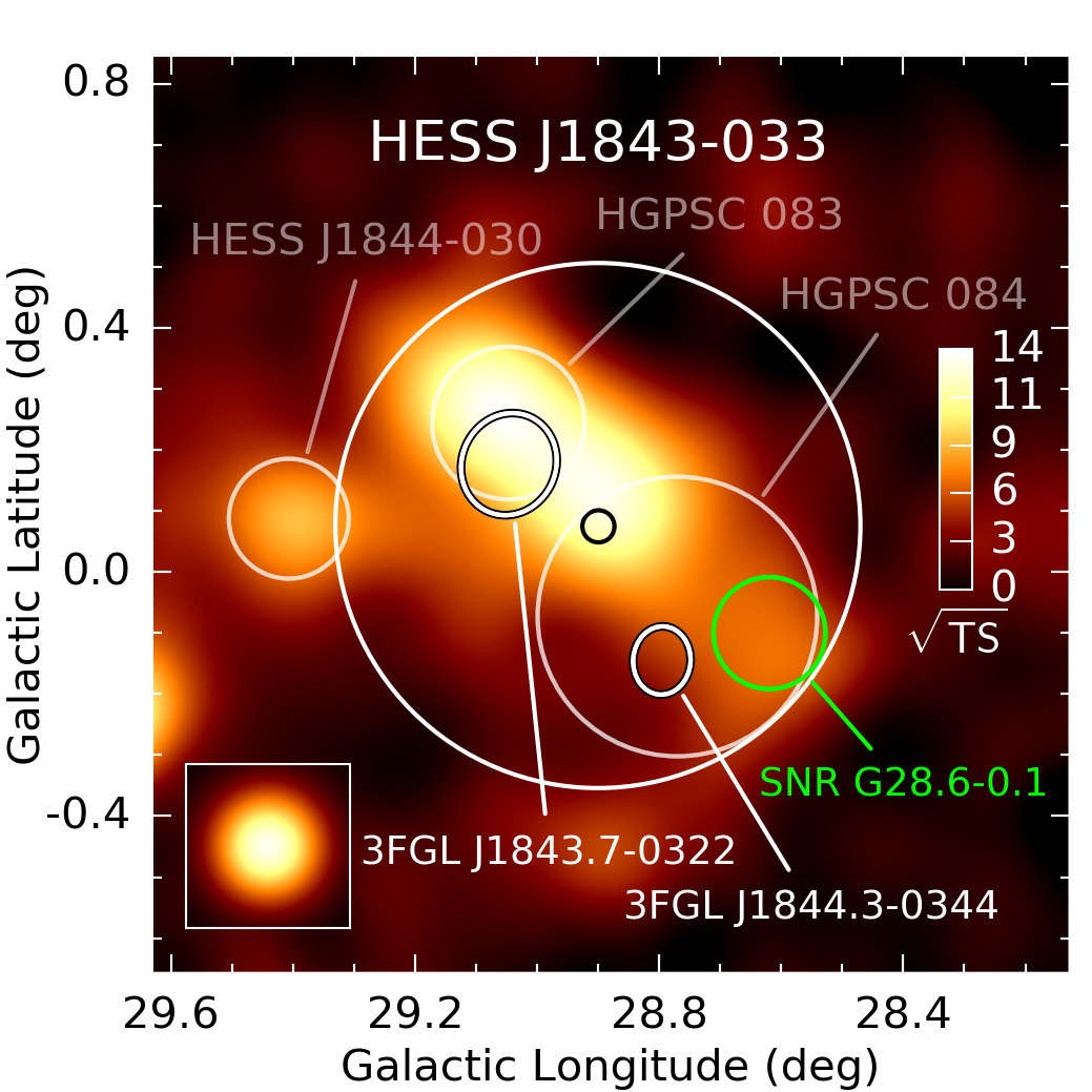
- Figure 28: HESS_J1843m033.pdf, PNG
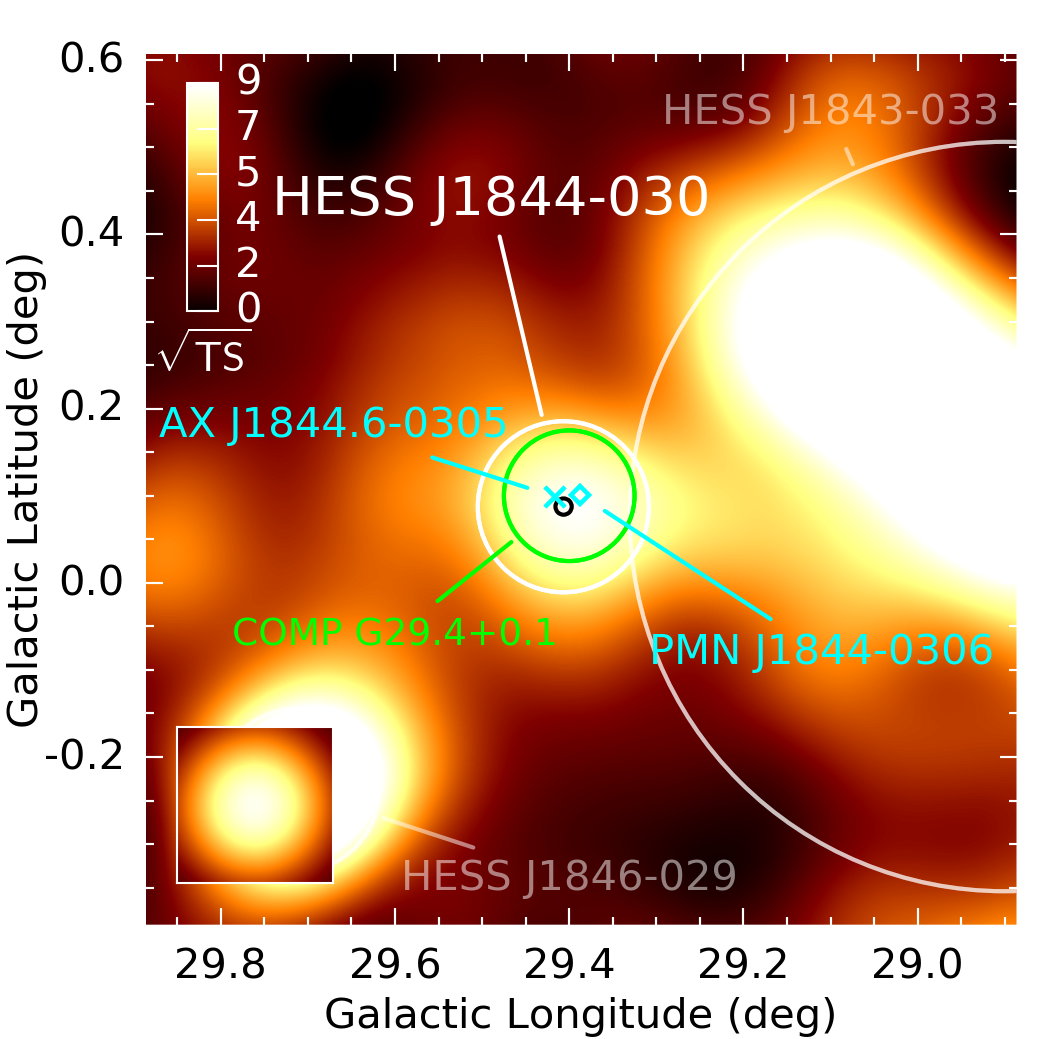
- Figure 29: HESS_J1844m030.pdf, PNG
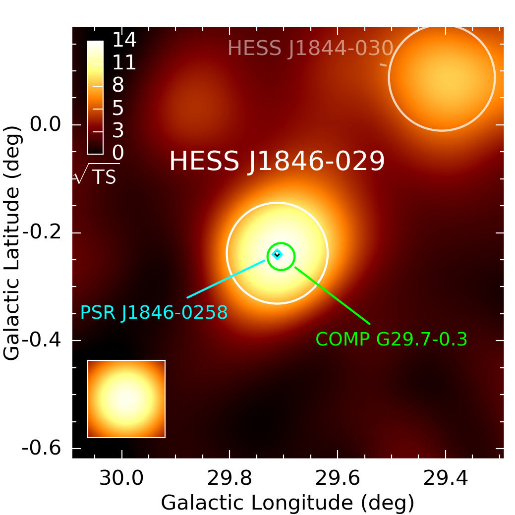
- Figure 30: HESS_J1846m029.pdf, PNG
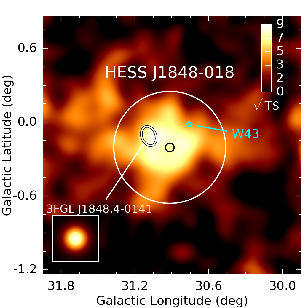
- Figure 31: HESS_J1848m018.pdf, PNG
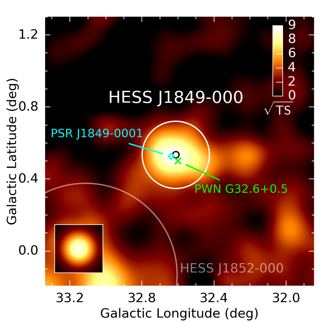
- Figure 32: HESS_J1849m000.pdf, PNG
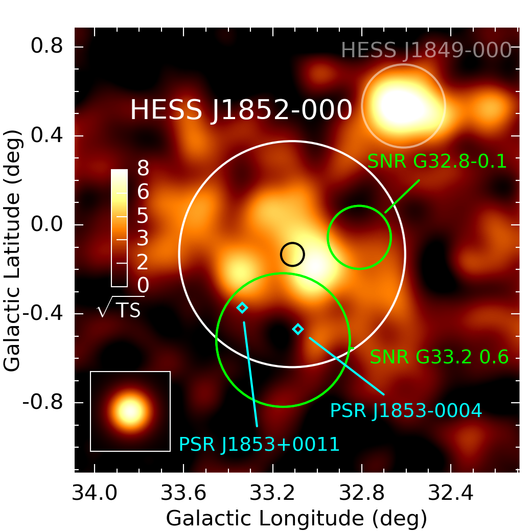
- Figure 33: HESS_J1852m000.pdf, PNG
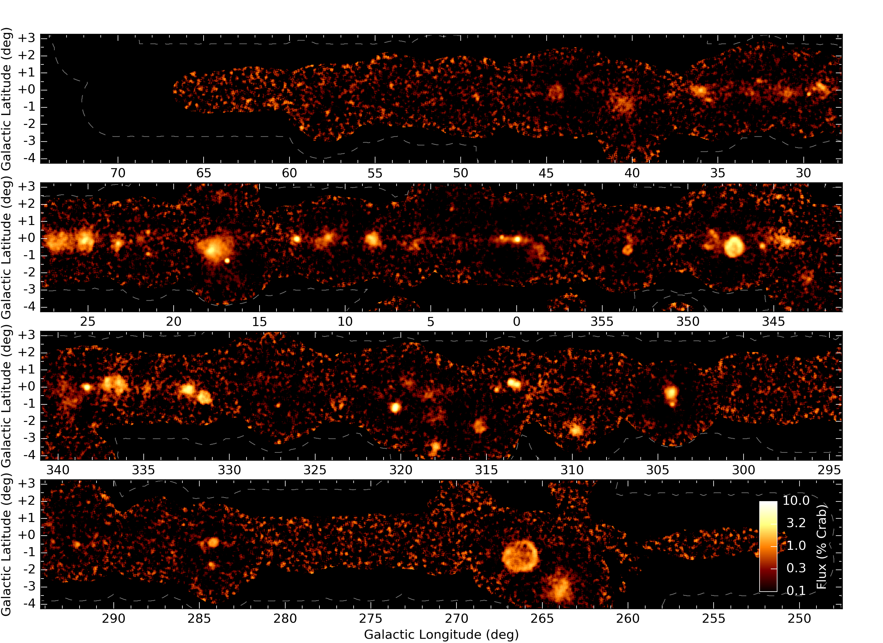
- Figure 34: hgps_survey_flux.pdf, PNG
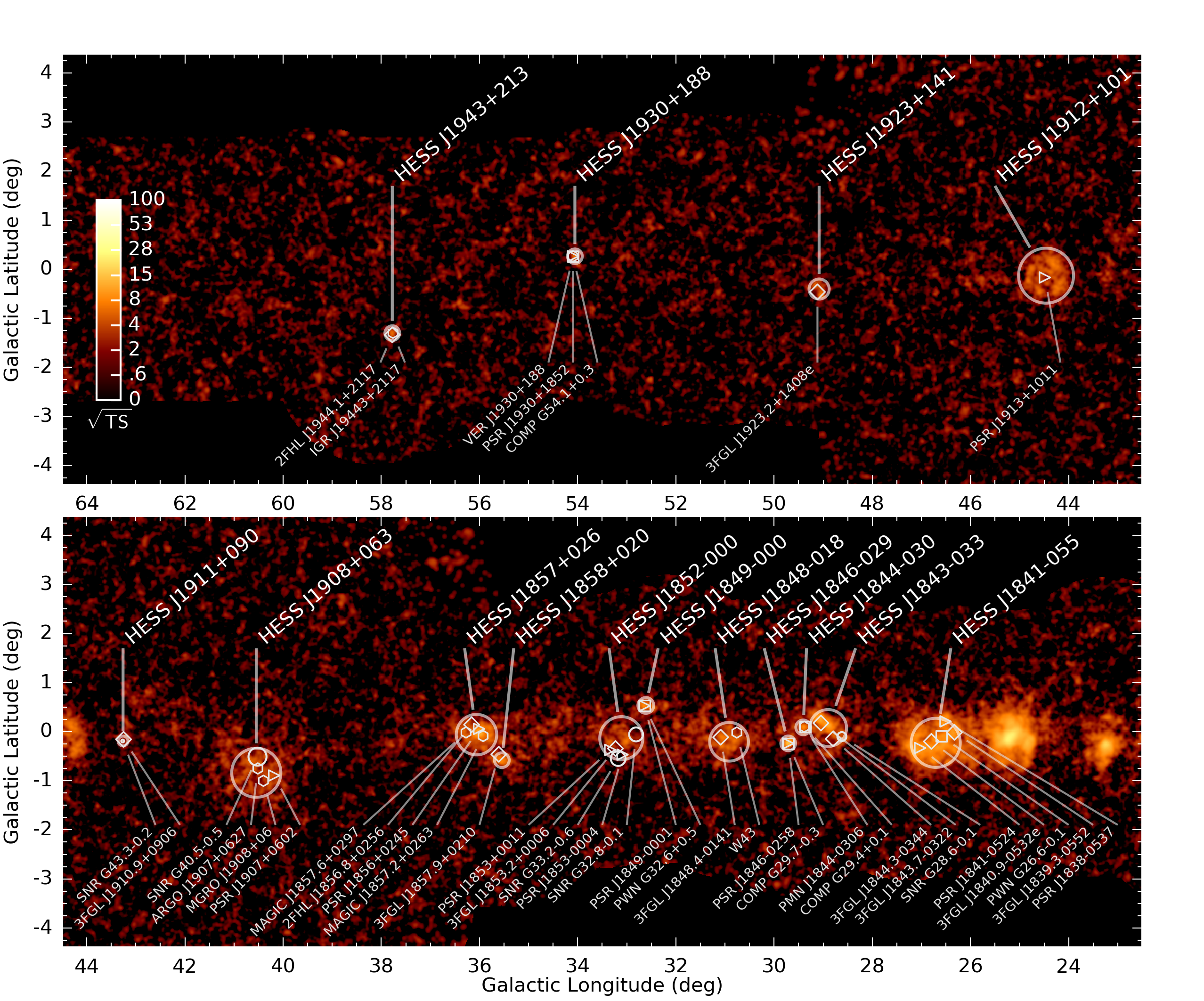
- Figure 35: hgps_survey_mwl_1.pdf, PNG
- Figure 36: hgps_survey_mwl_2.pdf, PNG
- Figure 37: hgps_survey_mwl_3.pdf, PNG
- Figure 38: hgps_survey_mwl_4.pdf, PNG
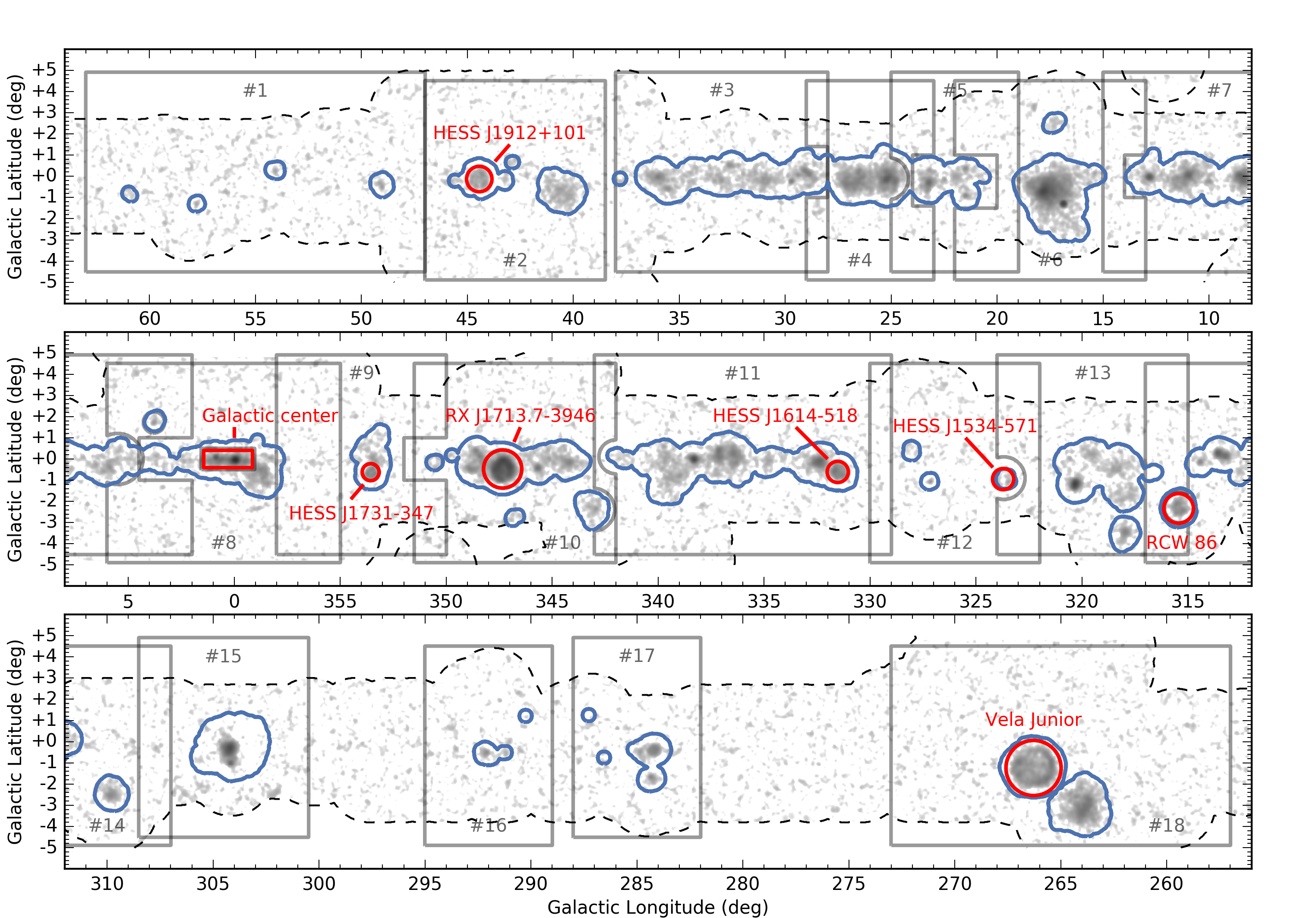
- Figure 39: hgps_survey_rois.pdf, PNG
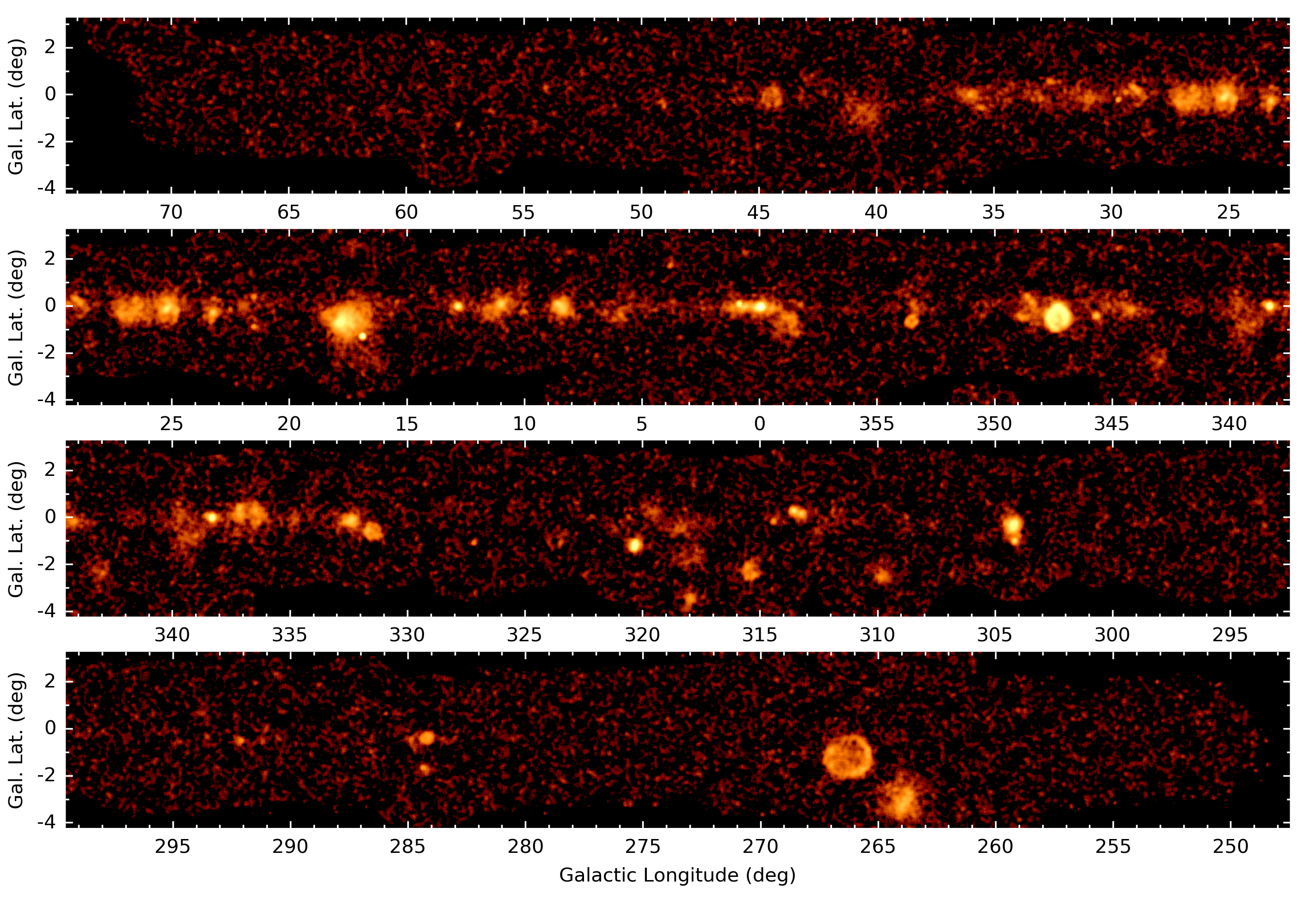
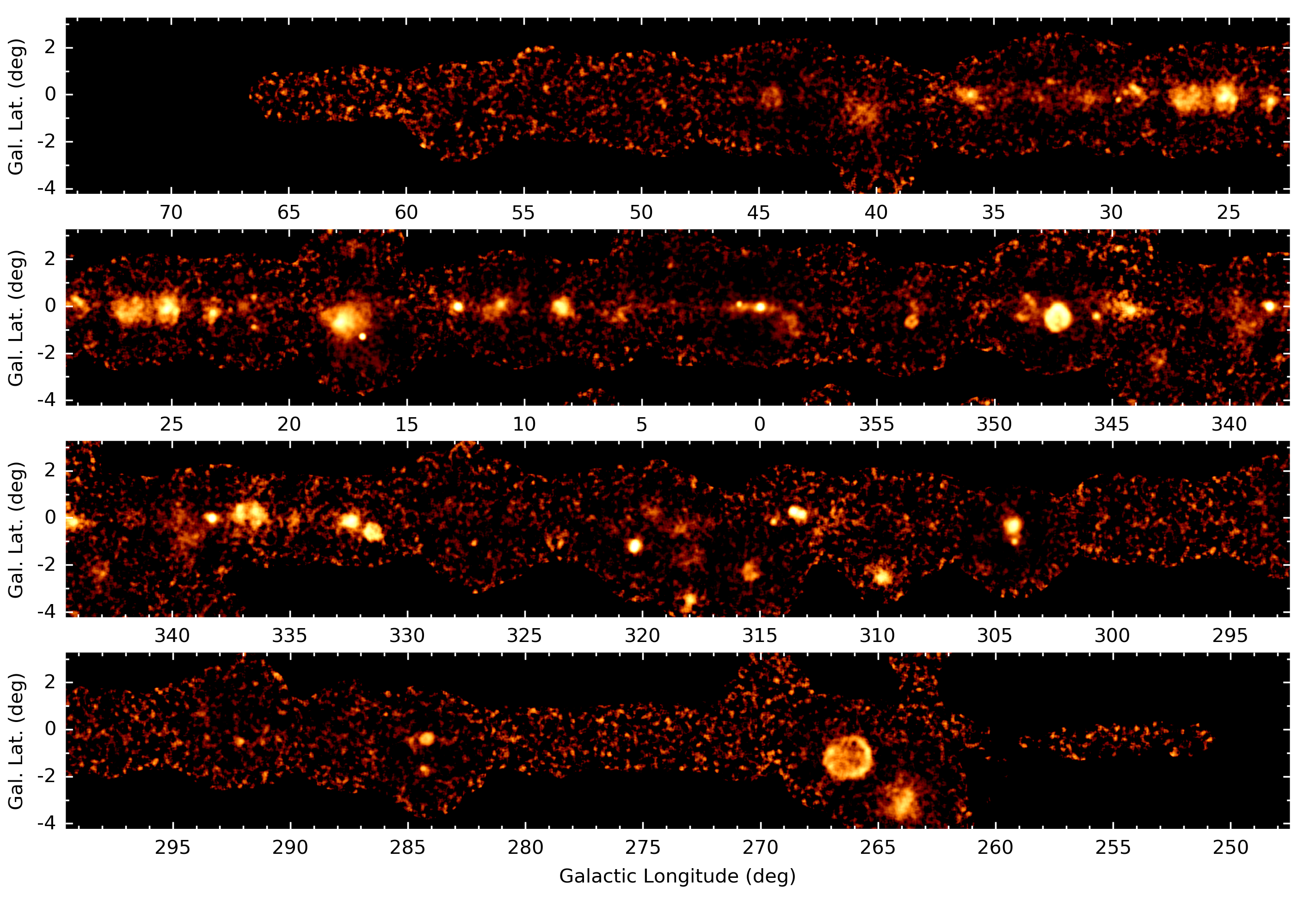
Extra figures #
For illustration purposes, we have produced the following extra figures from the release FITS files, showing the significance and flux survey maps at 0.1 deg resolution in a few different variants.
- Significance, single-panel, no sky image axes: hgps_survey_significance_single_panel_no_axes.png
- Significance, single-panel, with sky image axes: hgps_survey_significance_single_panel.png
- Significance, four-panel, with sky image axes: hgps_survey_significance_four_panel.png
- Flux, single-panel, no sky image axes: hgps_survey_flux_single_panel_no_axes.png
- Flux, single-panel, with sky image axes: hgps_survey_flux_single_panel.png
- Flux, four-panel, with sky image axes: hgps_survey_flux_four_panel.png
No colorbar was added on those images; if you're interested in absolute significance and flux values, please use the FITS images.
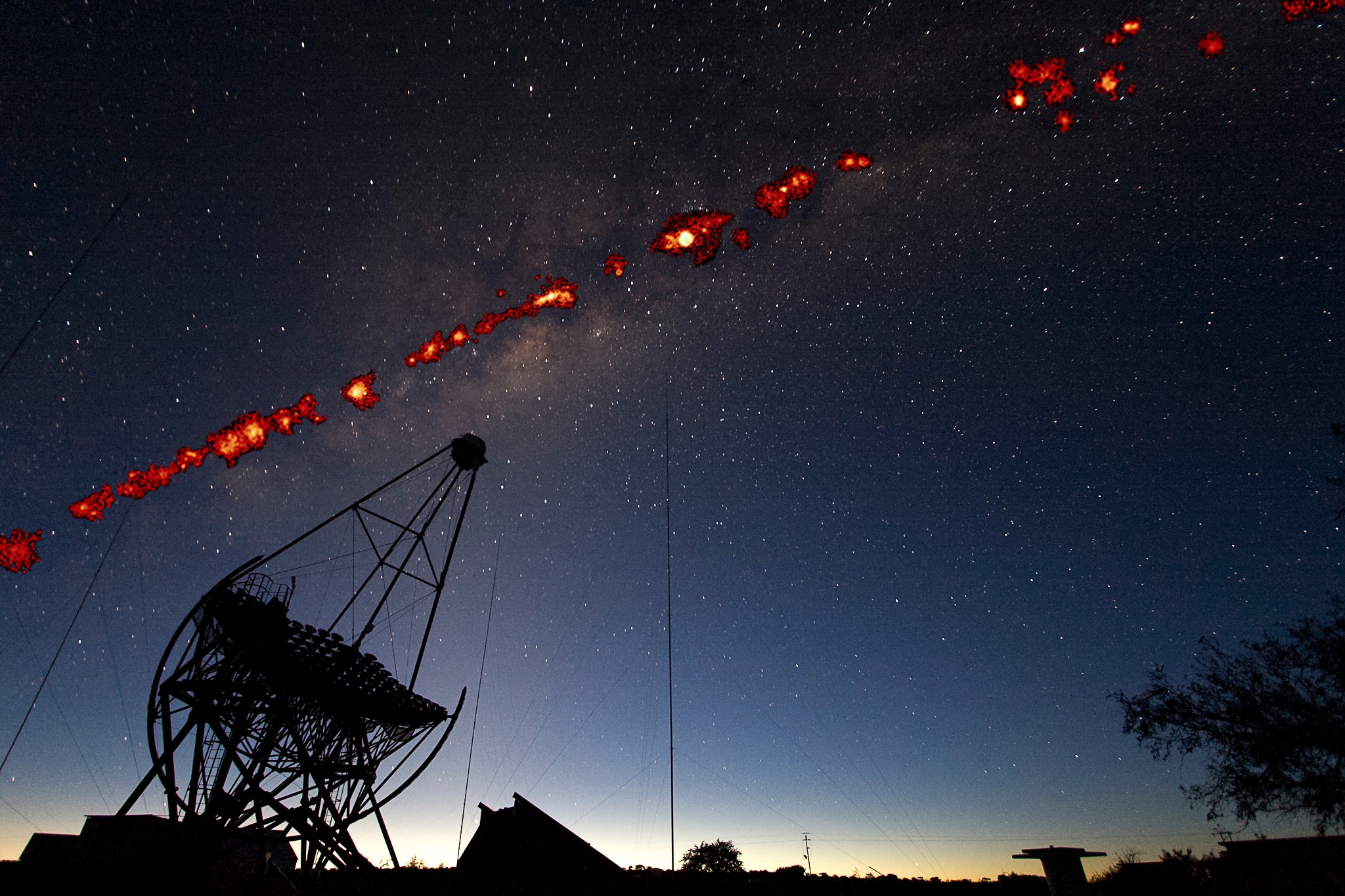
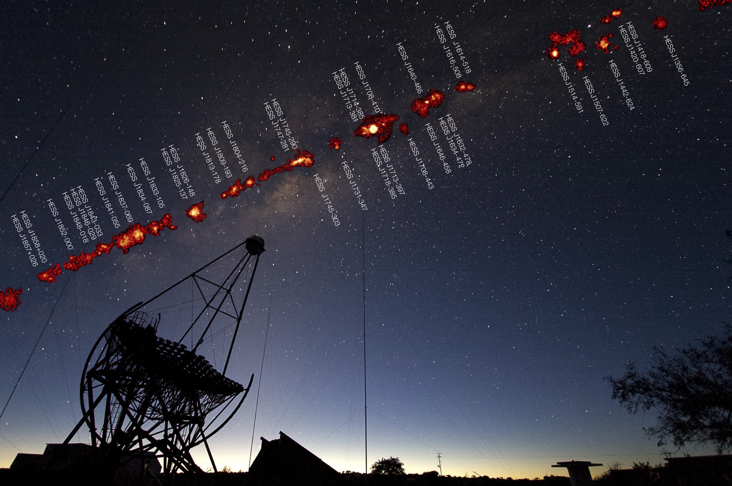
The cover image for the A&A special issue is a montage Galactic gamma-ray sources in the Milky Way above the H.E.S.S. telescopes in Namibia. The photo is an optical image, taken by Fabio Acero. Overlaid is a HGPS survey image showing the gamma-ray emission.
- No source labels: hess_hgps_montage.jpg
- With source labels: JPG and PDF
A video showing the time evolution of the HGPS significance image. The time interval between frames is 3 months.
- Four panel: figures/hgps_four_panel_time.mp4
- Montage: figures/hgps_montage_time.mp4
Extras #
This section contains some information that you might find helpful if you want to browse or work with the HGPS data.
- We have prepared a HGPS Jupyter notebook that contains a tutorial introduction how to work with the HGPS data using Python, Astropy and Gammapy. It shows e.g. how to access the catalog data and convert it to other formats (CSV files and DS9 region files), or how to plot a sky image or spectrum for a given HGPS source.
- The FITS files available for download can be viewed with any FITS viewer. For the survey maps you can use e.g. DS9 or Aladin, for the catalog and other tables TOPCAT.
- A HIPS version of the HGPS maps is available CDS: significance and flux. It can be viewed with Stellarium or Aladin.
Changelog #
- v1 (April 3, 2018) - Initial release